TAC Mapper- ATAK plugin Excels at handling massive Geospatial data (Points, Lines and Polygon) and perform Spatial Searching and finally ATAK can Support NSG/DGIWG/OGC Standards GeoPackage.
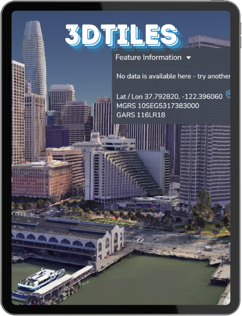
View 3D Augmented Reality map viewer with Google Photorealistic 3D Buildings and Terrain.
Rapidly Handle Massive Geospatial Vector Data from GeoPackage –
Vector Features (Points, Lines and Polgyons) as Dynamic png Raster Tiles.
Find the Nearest/Closest and View Attribute Table and Show Only what’s in the Map View in ATAK.
Spatial Searching
Attribute Search & Table/Grid View
Serve local GeoPackage Vector Features tables as Network Link KML with feature info popup support or as dynamic raster tiles with styling. (unlike shapefile which is limited to 2gb and KML which is XML text file)
GeoPackage is a SQLite database that can handle massive data and has RTREE Spatial Index for efficient spatial searching.
Also, because we are Rendering the Data as Tiles Users Can Control what Map Scale/Zoom Level to Display the Data.
In addition, a single file can include multiple tables and metadata.
3D/4D Augmented Reality Viewer
In your local web browser on your EUD – End User Device View Immersive Scenes with Device Sensors (Accelerometer, Compass, Gyroscope and Geolocation)

View OSM 3D Buildings from CesiumION
3D Tiles Buildings

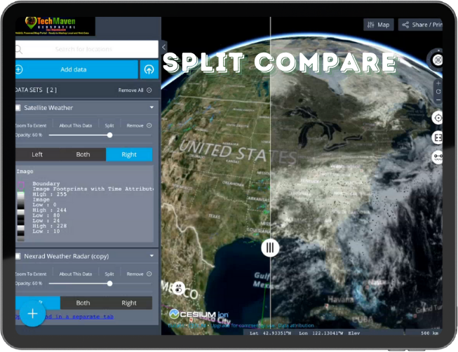
SWIPE/SPLIT to Compare Data
This Web Map can work offline with the local map tiles from MBTILES and GPKG and local GIS Files (GeoJSON, KML, GPX, Shapefile, CZML, GeoPackage Vector Features and other)
Load your own 3D Content:
🗸 OGC 3DTILES
🗸 OGC/ESRI i3S SceneServer
🗸🗸 CZML
🗸 3D KML
🗸 GLB 3D Models and Support for ASSIMP
Search for Data: US Government, State Gov’t and Local Gov’t Open Data Sites and rapidly connect and load data layers
Rapidly Connect to Open Geospatial Metadata Catalogs (CSW, CKAN, SOCRATA, SDMX, THREDDS, MAGDA, OpenDataSoft, ESRI REST Services, etc)
Load MBTILES and GPKG Vector Tiles with GL JSON Stylesheet
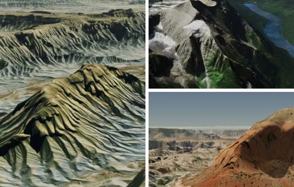
View 3D Terrain
View 3D Terrain from CesiumION & Load your own Quantized Mesh Terrain Tiles or ESRI ArcGIS Terrain Format LERC

4D Time Enabled (View WMS-T, CSV/TSV with Time, KML and GeoJSON with Time)
Connect to Live Sensor Data from OGC Sensor Observation Service (SOS)
Connect to Live Transit Data from GFTS
Configure a Map Configuration (JSON) and share with your team. Do it in the app or via our Catalog Generator Web App
Join the
Conversation!
Find out how Instant Connect optimizes communication and incident response, ensuring seamless coordination and faster resolution
Contact Us
We’ve Partnered with Tech Maven Geospatial to Offer Data:
https://portfolio.techmaven.net/dataservices/data-services-landingpage/
https://portfolio.techmaven.net/dataservices/3dtiles_3dmodels_3dgeospatialdata/
https://portfolio.techmaven.net/dataservices/map-tiling/
Ready to go Basemaps and Overlays
You can access these data products and API’s via Offline Map Data Generator iOS, Android and Windows app https://offlinedatadownloader.techmaven.net/
https://youtu.be/LdFqcroCaR4?si=54DFVCkR3w2VOdydp


